01History
Partition as event and continuing condition
Zarina was ten when British India was partitioned in 1947. The new boundary was not experienced only as a political line: it reorganized where relatives could live, how journeys were made, and which places could still be called home. She later described crossing at Wagah as an encounter between the country she loved on one side and the people she loved on the other. That emotional division gives the border its recurring force in her work.
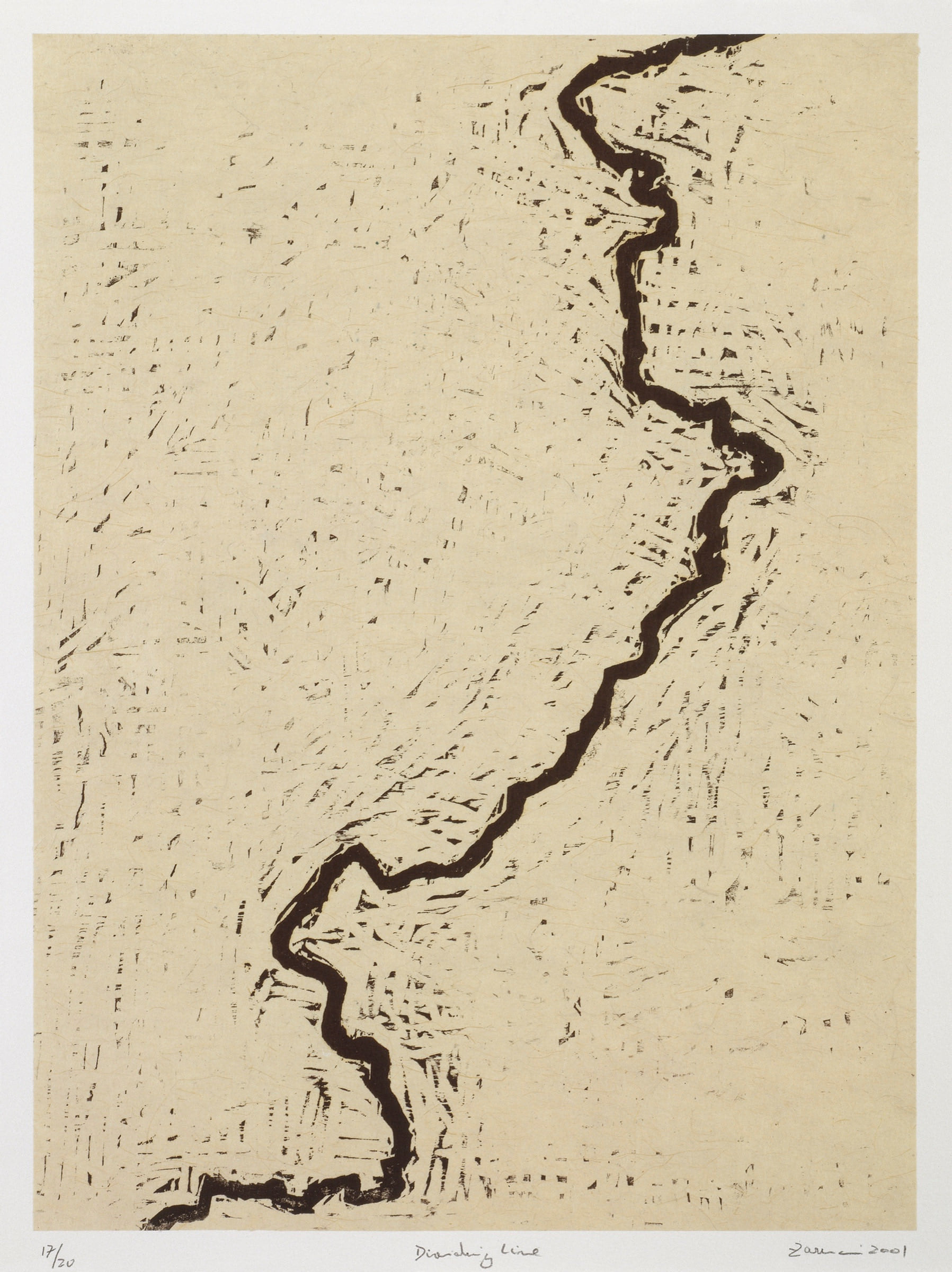
The maps do not confine Partition to a closed historical episode. Dividing Line and Atlas of My World attend to its afterlife: the way a line continues through memory, citizenship, language, fear, and family history. In that sense, “the body” is not an abstract metaphor. Borders are embodied when they determine where people may move, whom they may reach, and whether safety or return is possible.
02Method
A line made by removing everything around it
In Dividing Line, the boundary is produced through carving. Zarina cut away the field on either side so that the line stands forward from the block and prints as a dense, unsettled presence. This reversal matters: the border is not simply drawn on a surface. It emerges through pressure, removal, and the labor of gouging wood.
The surrounding marks prevent the image from behaving like a clean diagram. They make the sheet feel worked, resistant, and fragmentary. Recent scholarship has read this combination of paper, map, and gouge as a challenge to the authority of official cartography. The print does not clarify territory; it makes the violence and incompleteness of line-making impossible to ignore.
03Cartography
Maps of use, memory, and dislocation
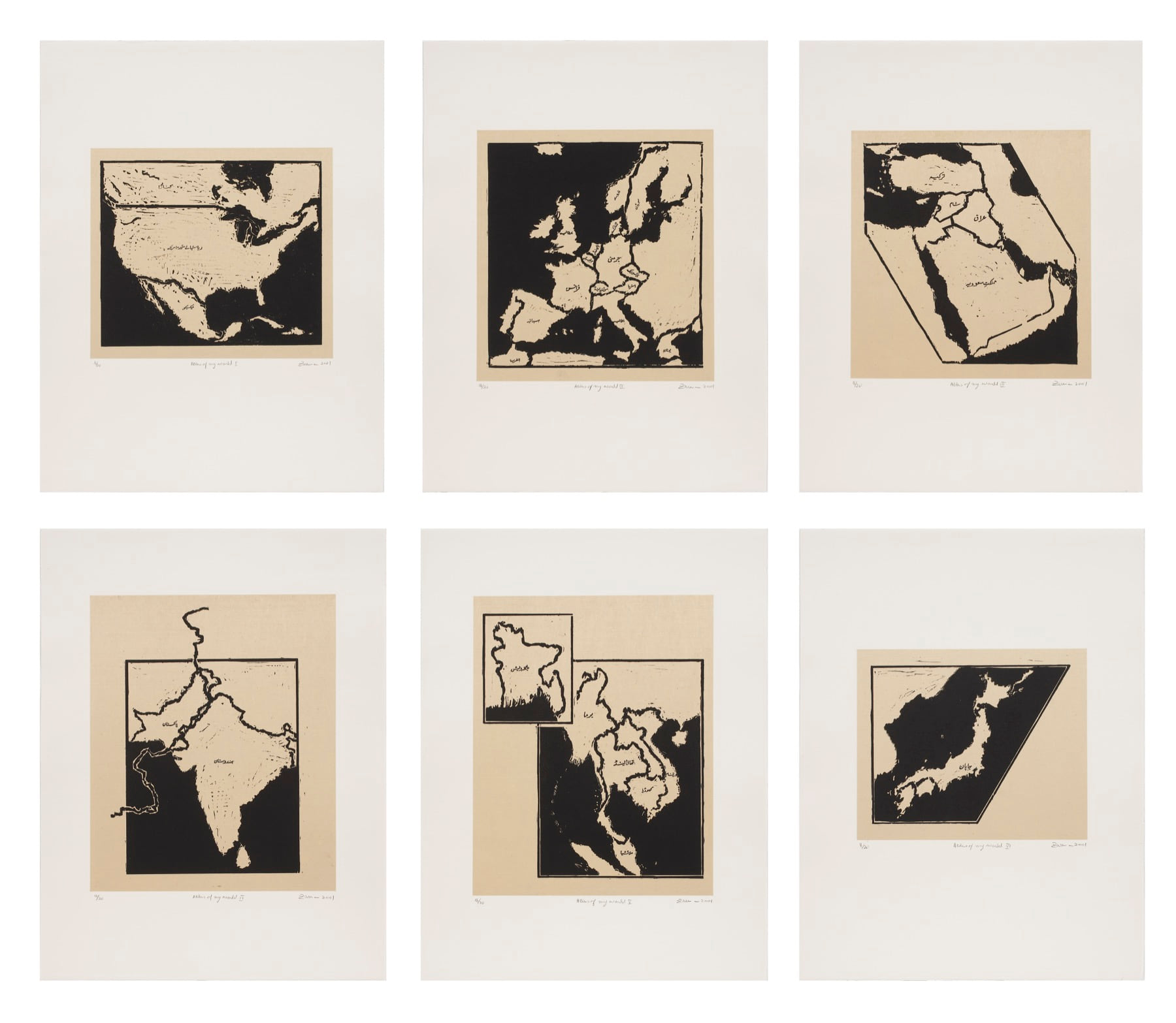
Zarina’s maps resemble countries, continents, routes, and city plans, but they do not claim the detached authority of a survey. They are built from proximate experience: places lived in, crossed, remembered, mourned, or imagined. Atlas of My World brings the regions of a peripatetic life into one portfolio, allowing personal geography to interrupt the supposedly neutral order of an atlas.
Recognition is often unstable. A coast darkens, a nation is split, a familiar territory appears inverted or suspended, and Urdu names insist that a place can be known through more than one language. The viewer is asked to locate, then to question the terms of location. The map becomes less a guarantee of knowledge than a record of the forces that make and unmake belonging.
04Witness
From national borders to damaged cities
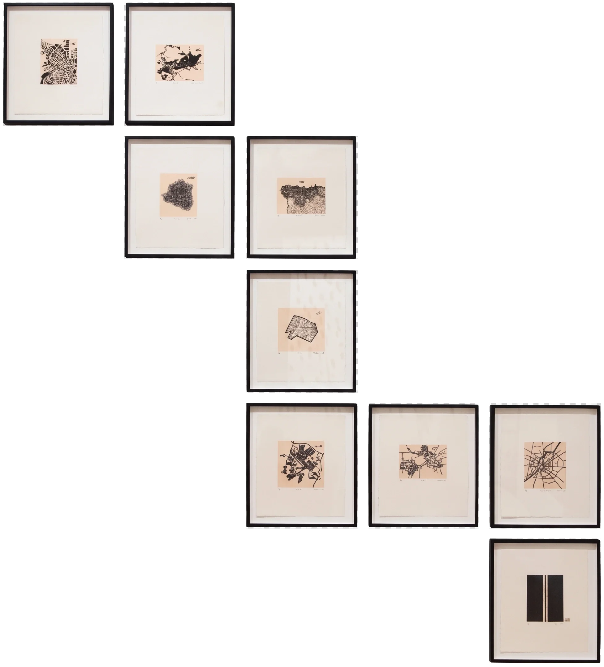
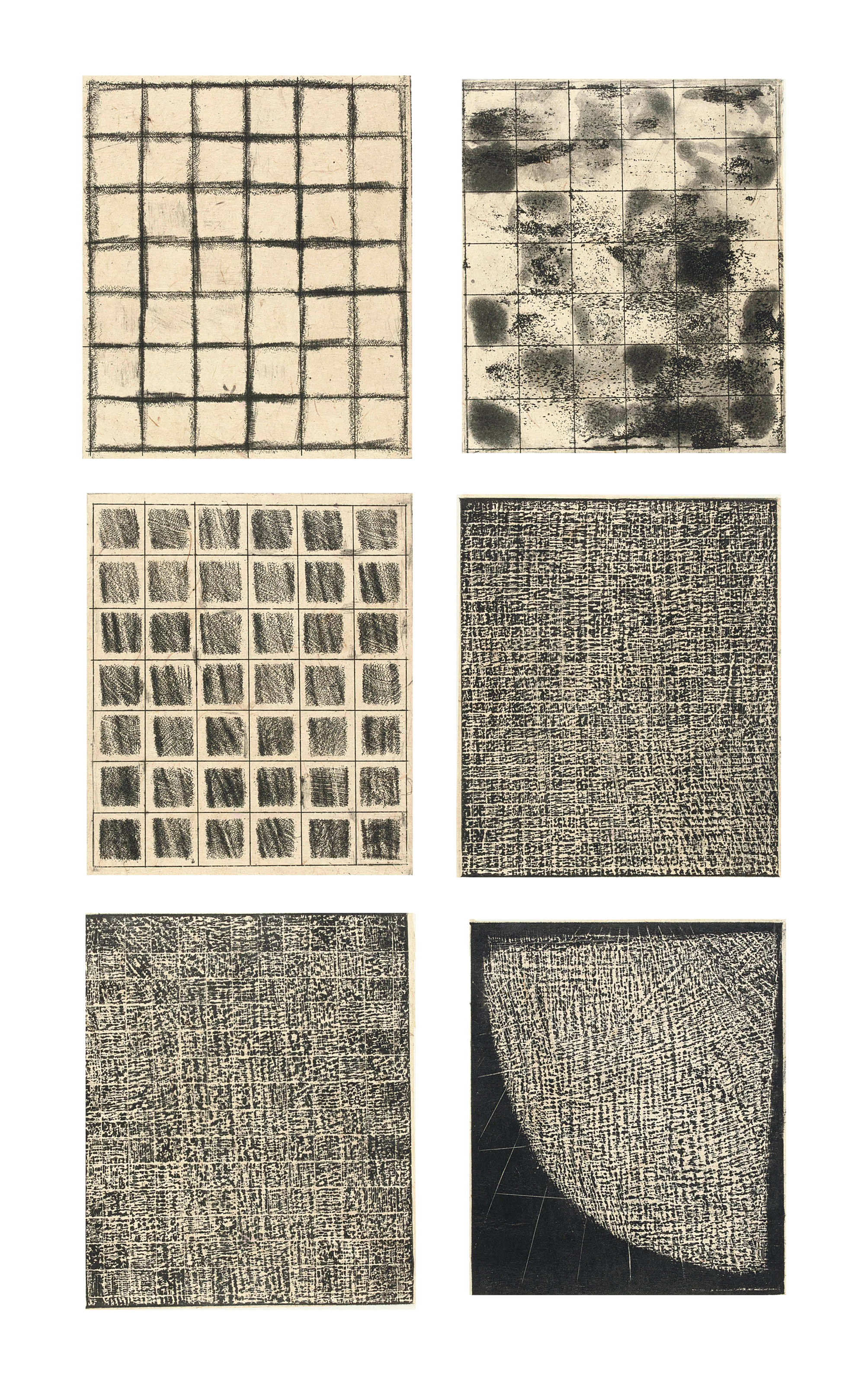
These Cities Blotted into the Wilderness extends the inquiry from India and Pakistan to Grozny, Sarajevo, Srebrenica, Beirut, Jenin, Baghdad, Kabul, Ahmedabad, and New York. Each woodcut translates a city marked by war, communal violence, massacre, or destruction into a distinct visual structure. Streets become fractures, enclosures, webs, rubble, coffins, or disappearing fields.
The series refuses the distance of the news map. Some cities were known through travel, some through research, and some through histories that touched Zarina’s own memories. Together they ask what remains when a place is reduced to an emblem of catastrophe. The prints operate as acts of witness: spare enough to avoid spectacle, specific enough to resist forgetting.
05Displacement
The border moves onto the sea
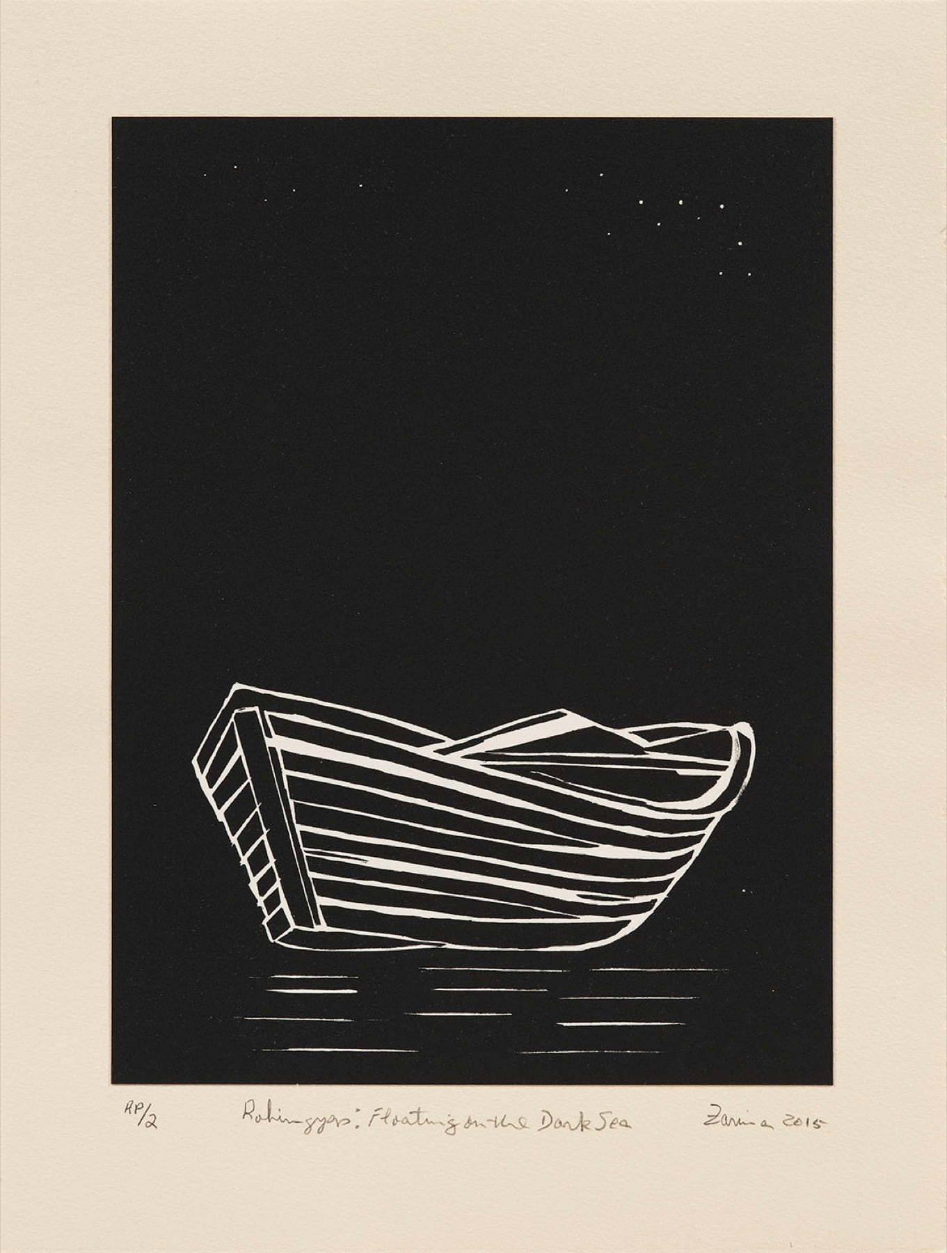
In Rohingyas: Floating on the Dark Sea, a white boat occupies a nearly black field beneath a small scatter of stars. There is no coast, harbor, route, or national outline. The map has disappeared, but the political force of borders remains in the condition of being unable to land. The boat is both shelter and exposure, carrying people through a space in which every direction is uncertain.
Made in 2015, the woodcut widens Zarina’s account of displacement beyond the land borders of Partition. It attends to a world in which borders also operate through denied passage, statelessness, forced waiting, and dangerous water. The immense dark field turns distance into a physical experience: the viewer must search for the small signs of boat, wake, and sky.
06Ethics
Abstraction without distance
Zarina’s reduction of a territory or city to black line is not an attempt to make conflict universal and anonymous. Titles, Urdu names, dates, and distinct structures keep each place specific. In These Cities Blotted into the Wilderness, Grozny does not look like Sarajevo, and Beirut does not look like Baghdad. Formal difference becomes a way of refusing the single image of a “war-torn city.”
The restraint also avoids turning suffering into spectacle. Dense cuts, broken grids, empty margins, and repeated impressions ask for sustained looking rather than instant recognition. Abstraction creates a space in which historical knowledge and visual experience must work together: the image does not narrate an event for us, but neither does it allow the named place to disappear.